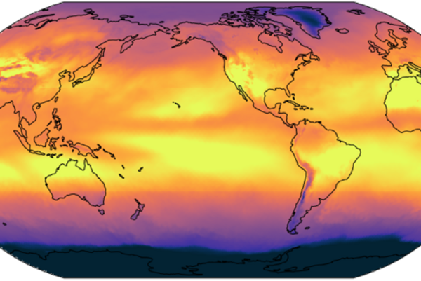
Earth’s self-regulation is weaker than assumed
Earth responds to temperature changes by emitting more or less thermal radiation into space. This mechanism, known as long-wave feedback, influences…
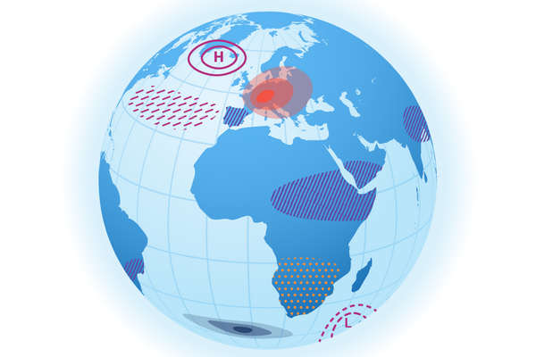
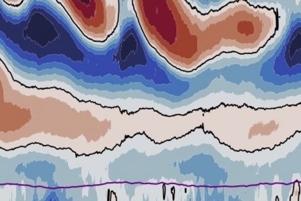
The influence of volcanic aerosol on climate depends on temperature
Stratospheric sulfate aerosol, as produced by large volcanic eruptions, cools the Earth and has been discussed as a climate engineering method.…
Regional climate signals pose new challenges for climate science
Climate science has correctly predicted many aspects of the climate system and its response to increased atmospheric carbon dioxide concentrations.…
![[Translate to English:]](/fileadmin/_processed_/a/5/csm_Noel_Hans_Chao_cbb534cbaa.jpg "[Translate to English:]")
Ocean, convection, adaptation: three new working groups starting at MPI-M
Three new working groups recently established at the Max Planck Institute for Meteorology (MPI-M) are tackling cutting-edge issues in climate…
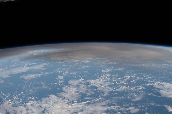
Above the clouds: HALO measurement campaign successfully completed
Over a period of more than three months, scientists have collected data on cloud formation in the Atlantic with the HALO research aircraft, and…
First-time explicit simulation of a tropical wind system in the upper atmosphere
A wind system in the tropical stratosphere that can influence the seasonal weather along many latitudes – the quasi-biennial oscillation (QBO) –…

A new generation of models for kilometer-scale climate projections
Imagine a future where climate science offers the appropriate tools to predict and thus help mitigate the impacts of climate change. This future is…

New study sinks an old theory for low-wind equatorial regions
MPI-M-researcher Julia Windmiller overturns a textbook explanation for the low wind speeds that tormented sailing ships in the tropics: Rather than…

WASCAL Master's Students Attend ORCESTRA Campaign on Climate Research
Five master's students from Ghana, Senegal, Nigeria, Benin, and Guinea, participating in the WASCAL program, had the unique opportunity to gain…
![[Translate to English:]](/fileadmin/_processed_/f/c/csm_T_Orcestra_Wolken_38a6d5472a.jpg "[Translate to English:]")
ORCESTRA: Exploring Tropical Clouds and their Impact on Climate
The ORCESTRA started his performance on August 10th in Cap Verde. The PERCUSION gives the beat by flying back and forth across the belt of deep rain…

Why stratospheric aerosol disproportionately cools the Indian and western Pacific Ocean
In a new study Moritz Günther, Hauke Schmidt, Claudia Timmreck, and Matthew Toohey show how aerosol perturbations in the stratosphere lead to a…

Linear climate response to idealized tropical volcanic eruptions
In a new study, Dr. Claudia Timmreck, Dr. Dirk Olonscheck and Dr. Shih-Wei Fang from the Max Planck Institute for Meteorology, together with…