
To help answer long standing questions about the statistical properties of shallow cumulus clouds and their link to our changing climate, measurements and a continuous data set are needed. Therefore, the Max Planck Institute for Meteorology together with the Caribbean Institute for Meteorology and Hydrology and several other participating institutions established a cloud observatory on the island of Barbados.
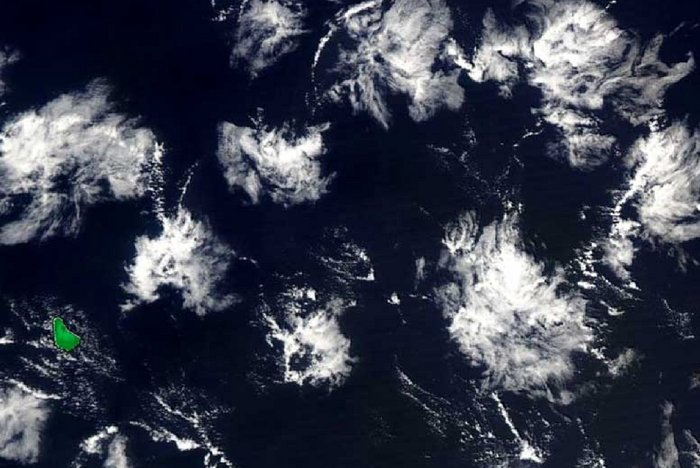
The research station “Barbados Cloud Observatory” at the easternmost point of the Caribbean island Barbados was built in 2009 and was put into operation in April 2010. Due to its exposed location, only 20 meters from the Atlantic coast, it enables measurements of the trade wind clouds, which are only minimally influenced by the land.
The station has a variety of different measuring devices that together provide a comprehensive and multi-layered picture of clouds, precipitation, aerosols, water vapor and wind in the atmosphere. The instruments use various physical principles, including radar, lidar and passive radiation-receiving systems. They routinely collect vertical profiles of the atmosphere at a variety of altitudes - ranging from the Earth's surface to several kilometers above. Over the past ten years, the station has been continuously developed and kept at the cutting edge of technology to ensure precise and reliable long-term data.
External website with status, data, and photos from the Barbados Cloud Observatory
Overview of measuring instruments
| Instrument | Instrument description: |
|---|---|
| Raman Lidar: | The upward looking multichannel Raman lidar uses a neodymium-doped yttrium aluminium garnet (Nd:YAG) 10-Hz laser with three wavelengths (355 nm, 532 nm and 1064 nm) to profile clouds and aerosol properties and to retrieve temperature and humidity profiles. The current Raman lidar is running since May 2019. Data from former Raman lidar instruments are available since April 2010. |
| Ka-Band Cloud Radar: | Upward looking polarized Doppler cloud radar to detect radar reflectivity, Doppler velocity and linear depolarization ratio of cloud particles. The radar is operating with a frequency of 35 GHz and has a sensitivity of -48 dBZ at an altitude of 5 km and -70 dBZ at an altitude of 500 m. It measures a vertical range between 150 m and 18.9 km with a vertical resolution of 30 m. The Doppler resolution is < 0.02 ms-1 between -10 ms-1 and 10 ms-1. Data are available since April 2015 with a temporal resolution of 10 s (2 s since July 2018). Data from a former radar with similar characteristics but a lower sensitivity are available since December 2010. |
| W-Band Cloud Radar: | Upward looking polarized Doppler 94 GHz cloud radar to detect radar reflectivity, Doppler velocity and linear depolarization ratio of cloud particles. The W-Band radar is measuring since December 2018 at altitudes between 150 m and 15 km with a temporal resolution of 2 s. |
| Two Doppler Lidar: | One upward looking (since July 2015) and another horizontal scanning Doppler lidar (since February 2019) to measure vertical and horizontal wind speed. Both instruments use a laser beam with a wavelength of 1500 nm to measure at an altitude between 50 m and ~1000 m. The temporal resolution of the vertical wind speed is 1.3 s. Horizontal wind speed and direction are averaged over an interval of 2 minutes. |
| Microwave radiometer: | Humidity and temperature profiling radiometer (HATPRO). Two bands, 22 - 31 GHz and 51 - 58 GHz. The vertical resolution is less than 40 m in the sub-cloud layer with a temporal resolution of ~1 minute. Data from the current microwave radiometer are available since April 2017. Data from a former microwave radiometer are available since January 2011. |
| Micro-Rain-Radar: | Upward looking 24 GHz Micro-Rain-Radar to detect fall velocity of hydrometeors and rain rate. Both parameters are measured at an altitude between 100 m and 3 km with a temporal resolution of 1 Minute. Data are available since April 2010. |
| Ceilometer: | The Ceilometer is using a non-visible laser beam with a wavelength of 1064 nm to detect the cloud base height up to ~10 km. It is running since 2010 with a temporal resolution of 10 s. |
| Radiation: | Pyranometer, Pyrgeometer and Pyrheliometer for radiance and irradiance measurements. The temporal resolution is 1 s and the instruments are running since April 2015. |
| Weathersensor: | Two meters above ground, several sensors measuring pressure, temperature, humidity, precipitation, wind speed and wind direction since December 2010 with a temporal resolution of 10 s. |
| Disdrometer: | Detects drop size distribution and velocity of falling hydrometeors. Data are available since May 2017. |
| Allsky and Thermal Imager: | The Allsky-Imager uses a fish-eye objective to take a picture every minute of the entire sky. The center part of the picture is also covered by an IR-Camera, which detects the temperature at the cloud base. Pictures of the Allsky-Imager are available since 2010. The thermal camera has taken pictures since the end of 2018. |
| Webcam Movies: | A camera located at Ragged Point faces towards the easterlies and shows the daily weather situation in the vicinity of the Barbados Cloud Observatory. The daily movies are available since February 2010. |
Measurements and data collected at Ragged Point, the location of the Barbados Cloud Observatory
-
GAWSIS data entry: includes the greenhouse gas measurements performed at the Ragged Point station
-
Trajectory calculations for Ragged Point: backward trajectory calculations initialized every 4 hrs on 6-hourly ECMWF analysis fields
Publication
Description of the BCO: Stevens, B., et al., (2016). The Barbados Cloud Observatory — anchoring investigations of clouds and circulation on the edge of the ITCZ. Bulletin of the American Meteorological Society, 97, 787-801, doi:10.1175/BAMS-D-14-00247.1
More Content

Changes in Cloud Altitude Have Minimal Impact on Climate Sensitivity
Clouds influence how much the Earth warms in response to a given increase in atmospheric carbon dioxide. In addition to their extent and brightness,…

Climate change amplified by permafrost cloud feedback
Researchers at the Max Planck Institute for Meteorology shed light on what may happen if the frozen soils thaw in response to global heating.…